
사진
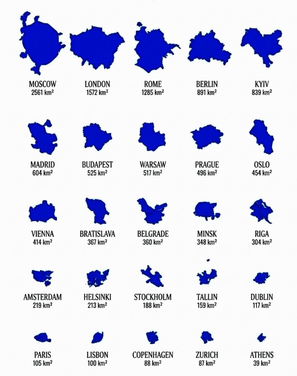
European Cities By Size
@taiki님의 사진· Aug 15, 2026· Education
이 사진에 대해
The image displays a grid of blue silhouettes representing the shapes of various European cities. Each city shape is accompanied by its name and area in square kilometers. The overall style is infographic-like and educational. The most notable visual aspect is the stark contrast between the largest city, Moscow, and the smallest, Athens, highlighting the significant differences in their geographical footprints. MOSCOW 2561 km² LONDON 1572 km² ROME 1285 km² BERLIN 891 km² KYIV 839 km² MADRID 604 km² BUDAPEST 525 km² WARSAW 517 km² PRAGUE 496 km² OSLO 454 km² VIENNA 414 km² BRATISLAVA 367 km² BELGRADE 360 km² MINSK 348 km² RIGA 304 km² AMSTERDAM
?


